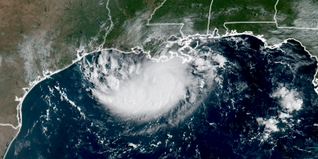
- Edouard was designated as Invest 97L, Potential Tropical Cyclone Five, and Tropical Depression Five in less than 24 hours.
- Edouard became the fifth named storm of the 2026 Atlantic hurricane season Monday evening.
- Tropical Storm Edouard strengthened in the Gulf with sustained winds of 40 mph.
- Hurricane watch has been issued from High Island, Texas, to Cameron, Louisiana, indicating winds of 74+ mph are possible on Tuesday.
- Tropical storm warnings are in effect from Port Bolivar, Texas, to the Vermilion/Iberia Parish Line in Louisiana, meaning winds of 40+ mph are expected beginning on Tuesday.
- Edouard is expected to reach the Texas or Louisiana coast on Tuesday, with landfall potentially as early as 1:00-3:00 p.m. ET.
- Edouard is forecast to move inland over eastern Texas Tuesday afternoon or evening, then dissipate by early Thursday.
- Warnings and watches have been issued for the Gulf Coast, including a storm surge warning from High Island to Cameron.
- Heavy rain and flash flooding are expected as Edouard moves inland, with 3-6 inches of rainfall forecasted, and up to 9 inches possible on the upper Texas Coast.
- Wind shear is fairly light and Gulf water temperatures are in the upper 80s, both favorable for additional development.
- Edouard could briefly become a hurricane near landfall.
Tropical Storm Edouard formed in the Gulf, rapidly intensifying from a tropical depression to a named storm within 24 hours.123
Edouard is expected to make landfall on Tuesday, with sustained winds of 40 mph and moving west-northwest at 6 mph.
A hurricane watch is in effect from High Island, Texas, to Cameron, Louisiana, indicating potential winds of 74+ mph.4
The storm is forecast to bring 3-6 inches of rain, with localized areas possibly receiving up to 9 inches along the upper Texas Coast.9

Flash flooding is a significant concern, particularly in the Houston metro area, which could see 3 to 5 inches of rain.
A storm surge warning has also been issued, with surges of up to 5 feet expected along the coast.8
The National Hurricane Center (NHC) noted that while Edouard may not last long, its impact could be severe, especially in areas already experiencing drought conditions.
The storm is anticipated to move inland on Wednesday and dissipate by early Thursday, but heavy rain bands may linger, increasing the risk of flash flooding in eastern Texas.
“The National Hurricane Center reports Edouard has sustained winds of 40 mph and is moving west-northwest at 6 mph. A storm surge warning is in effect from High Island, Texas, to Cameron, Louisiana, with up to 5 feet of surge possible, and 3-6 inches of rain expected, with up to 9 inches on the upper Texas Coast.”
 FOX Weather
 The Weather Channel



