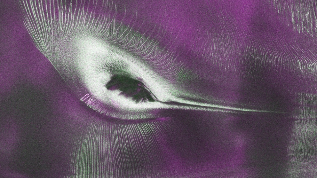
- NISAR's L-band radar captured an image in August 2025 that resembles a hummingbird, showcasing the unique ice structures of Nunatak Zaterjavshijsja in East Antarctica.
- NISAR began collecting L-band observations for public release on June 17, 2026, with the initial public release occurring on July 20, 2026.
- Calibrated L-band data from the NISAR mission is now available through the Alaska Satellite Facility Distributed Active Archive Center and NASA Earthdata, allowing researchers to access valuable information about Earth's changing surface.
- NISAR is the first joint satellite mission between NASA and the Indian Space Research Organisation (ISRO), designed to provide a detailed view of Earth's changing surface using L-band and S-band radar systems.
- The L-band radar can detect features that shorter wavelengths often cannot, making it particularly valuable for studying glaciers, ice sheets, and other subtle changes across Earth's surface.
- NISAR's imaging capabilities allow it to build a consistent, long-term record of surface change, supporting research on glacier dynamics and the effects of climate change on Antarctica.
NISAR's advanced L-band radar technology has unveiled a remarkable image of Nunatak Zaterjavshijsja, a rocky mountaintop in East Antarctica, which appears to resemble a hummingbird. This optical illusion is created by the mountain's shape and the surrounding ice, with deep crevasses forming sharp green lines across the surface.36
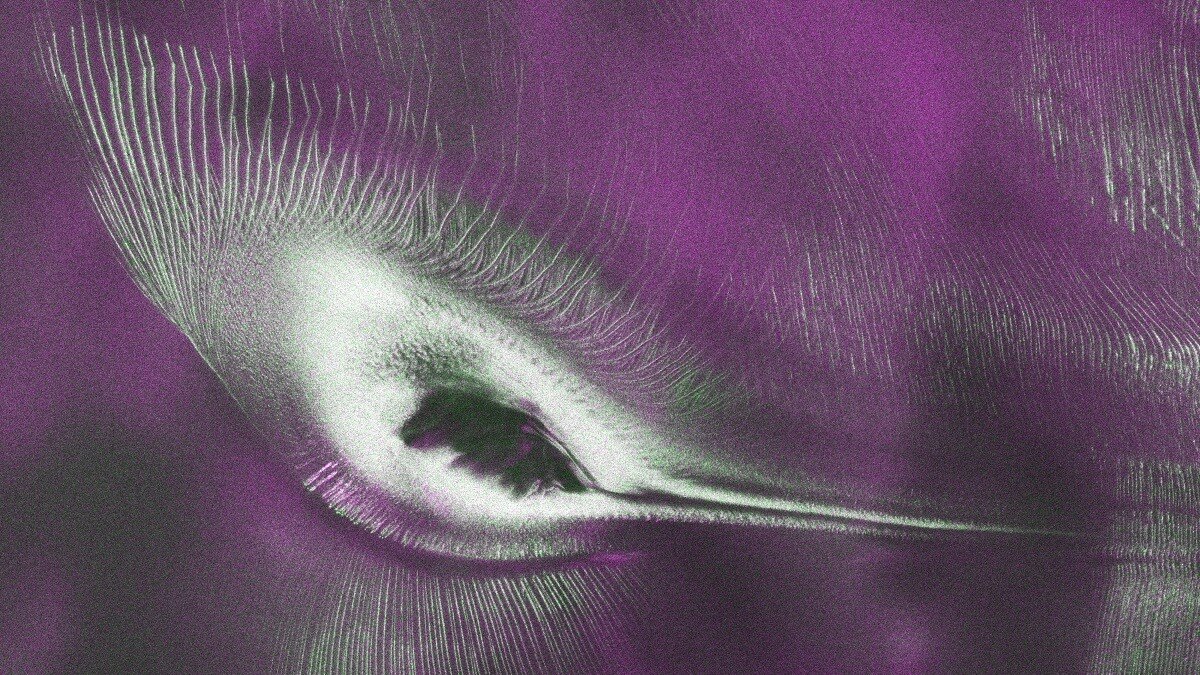
Captured in August 2025, the image demonstrates NISAR's capability to monitor remote regions, providing crucial data on glacier dynamics and ice-sheet stability. The satellite operates by sending polarized microwave radar waves, allowing it to penetrate clouds and darkness, revealing features invisible to conventional optical imagery.
“The hummingbird is actually Nunatak Zaterjavshijsja, a rocky mountain peak rising above the East Antarctic ice sheet,” NASA explained. The satellite's L-band radar can detect subtle changes in the landscape, making it invaluable for studying ecosystems, natural hazards, and climate change impacts.
NISAR, a collaboration between NASA and ISRO, is the first Earth observation satellite to utilize two Synthetic Aperture Radar instruments at different wavelengths. The mission aims to build a long-term record of surface changes, with complete data expected by the end of 2026. By imaging the same locations every 12 days, NISAR will enhance our understanding of how glaciers and ice sheets respond to climate change, contributing to global sea level rise.

The initial public release of L-band data began on July 20, 2026, with ongoing updates as new acquisitions are processed, expanding the record of Earth's changing surface.
“The hummingbird illusion captured by NISAR's L-band radar is actually Nunatak Zaterjavshijsja, a rock peak where ice stresses create deep crevasses visible as green lines; the image was produced in August 2025. Separately, NASA clarified it is not preparing to place astronauts into hibernation for Mars missions, stating the required infrastructure does not currently exist.”




