- Environment Canada has issued a yellow heat warning for several regions, including Niagara Falls, indicating maximum temperatures of 30 to 32 C on Wednesday.
- Humidity will make it feel near 40 degrees.
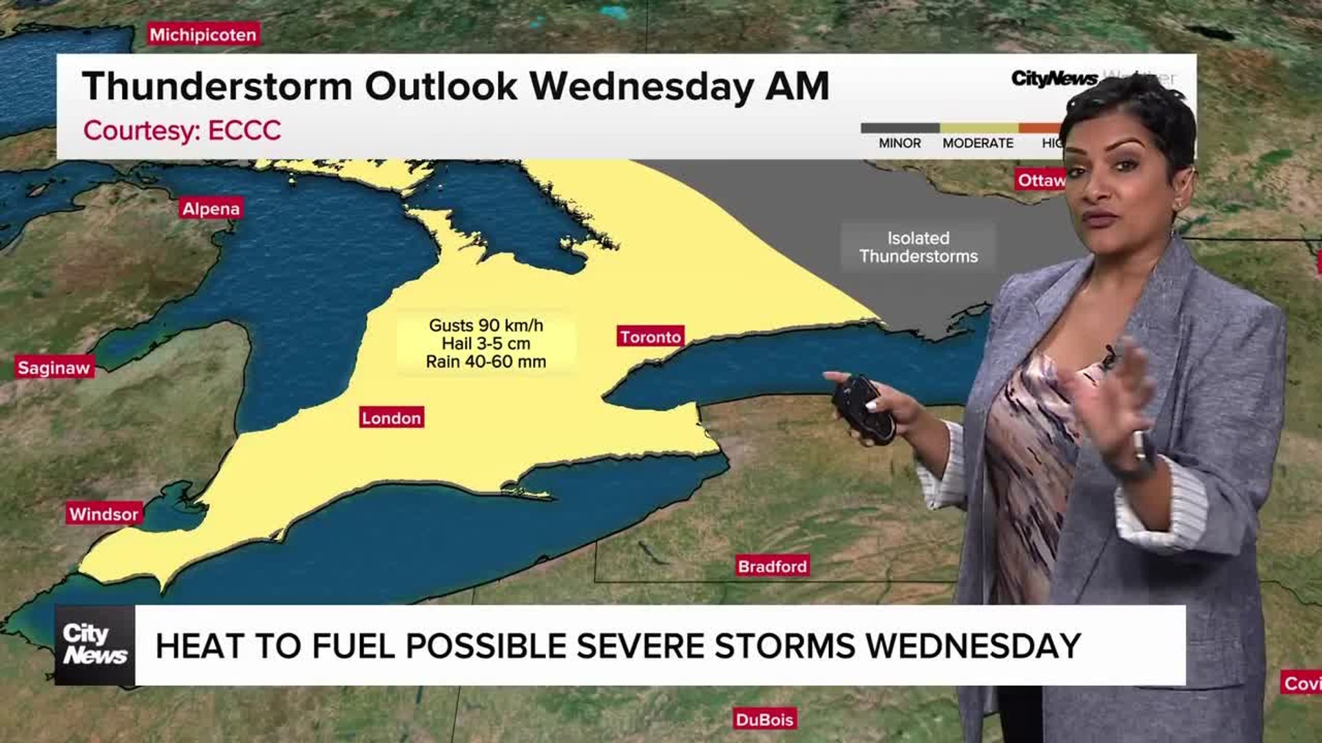
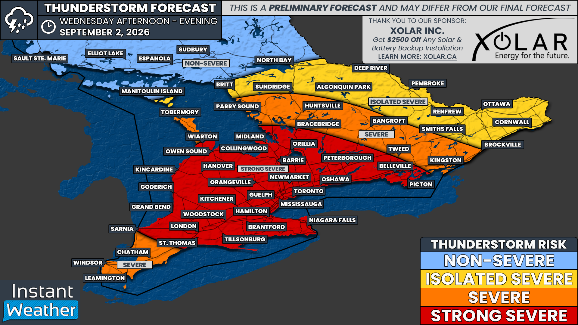
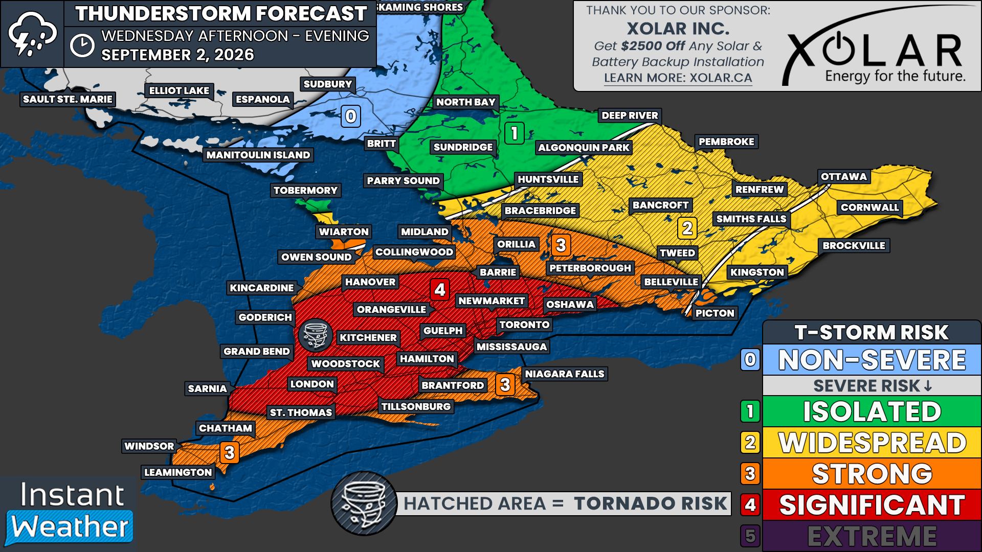
- A significant severe weather risk is expected across southern Ontario on Wednesday afternoon and evening, with potential for tornadoes, destructive winds, and hail up to tennis ball size.
- The main complex of storms is expected to develop between 2-6 PM, with the highest severe weather threat around the Lake Huron shoreline extending through London and Kitchener to the Greater Toronto Area.
- Showers with thunderstorms are expected to begin in the evening and end after midnight, with a second wave bringing an additional 15 to 25 millimetres of rain.
- On Monday, the Toronto and Region Conservation Authority (TRCA) reported that its watersheds received 8-55 mm of rain, saturating the ground.
- The TRCA warned that the ground is saturated, which will limit the ability to absorb more rainfall, increasing the risk of flooding in flood plains and low-lying areas.
Environment Canada has issued heat warnings for southern Ontario, forecasting maximum temperatures of 30 to 32 C and humidity making it feel like 40 degrees. The heat event may extend into Thursday for Windsor and Essex County, though confidence is low.123
Severe thunderstorms are anticipated, with the potential for tornadoes, destructive wind gusts, and hail up to tennis ball-sized. The highest threat is expected around the Lake Huron shoreline, extending through London and Kitchener to the Greater Toronto Area.4
Models indicate storms could develop as early as 2 to 3 PM, sweeping through Southwestern Ontario before reaching the Greater Toronto Area around dinner time. A later development could allow the atmosphere to become more unstable, increasing the risk of isolated thunderstorms that may evolve into supercells capable of producing severe weather.
The Toronto and Region Conservation Authority (TRCA) warns of potential flooding due to saturated ground conditions, with 8 to 55 millimetres of rain already recorded. The TRCA cautions that heavy rain from thunderstorms could lead to flooding in low-lying areas that do not drain well.78
Overall, the combination of extreme heat and severe weather poses significant risks for residents across southern Ontario today.
“The Toronto and Region Conservation Authority warns of higher flooding potential as its watersheds have already received 8-55 mm of rain Monday, leaving the ground saturated. The significant risk zone stretches from Lake Huron through London and Kitchener to the Greater Toronto Area, with a strong risk covering Niagara and a widespread risk for eastern Ontario.”
 Global News
 instantweatherinc.com