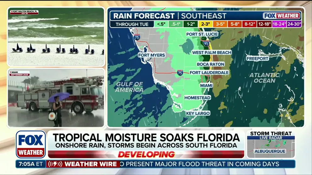
- Rain starts Friday and is expected to hold through at least Tuesday.
- Downpours are expected at times along the coast, increasing the flooding threat through the weekend.
- Heavy downpours could lead to flooding Sunday, with even heavier rain expected on that day.
- Winds will be increasing into Sunday and Monday, with speeds near 20-25 mph and higher gusts.
- Coastal Flood Alerts have been issued from Miami to Charleston, with King Tides driving a multiday flood threat spanning 500 miles.
- Totals between 3 and 5 inches of rain are possible across South Florida.
- This moisture is expected to bring widespread 3 to 5 inches of rain across South Florida into early next week.
- Rain rates of 1 to 2 inches per hour are possible, putting the area under a level 1 out of 4 flash flood risk on Saturday.
- The level 1 out of 4 threat will remain in effect through Tuesday, according to the FOX Forecast Center.
- Seasonal King Tides are keeping coastal waters elevated, contributing to the flooding risk.
- Persistent, gusty winds of 20 to 25 mph will push water inland, keeping minor-to-moderate coastal flooding in play during peak high tides into the weekend.
- Areas in and around Jacksonville face potential flooding caused by a river trapping effect, where winds prevent inland water from draining out of the mouth of the St. John's River.
- Coastal flooding could be particularly disruptive around Charleston, where even minor tide increases can flood low-lying major roads and historic districts.
- A King tide is the highest naturally occurring high tide of the year.
- Even on clear, sunny days with no storm in sight, these extra-high seasonal tides push seawater back up through storm drains and onto coastal streets.
South Florida is facing a significant weather event this weekend, with forecasts indicating heavy rain and strong winds. Rain is expected to begin Friday and continue through at least Tuesday, with totals between 3 and 5 inches likely across the region.156
Heavy downpours could lead to flooding, particularly on Sunday, with rain rates of 1 to 2 inches per hour possible.23411
The FOX Forecast Center has issued a level 1 out of 4 flash flood risk for Saturday, escalating to a level 2 threat on Sunday into Monday.
Coastal Flood Alerts have been issued from Miami to Charleston, South Carolina, driven by seasonal King Tides that elevate coastal waters and increase flooding risks.78
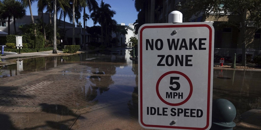
Persistent winds of 20 to 25 mph will exacerbate the situation, pushing water inland and maintaining minor-to-moderate coastal flooding during peak high tides.16
Areas around Jacksonville may experience flooding due to a river trapping effect, while Charleston could see disruptions as even minor tide increases flood low-lying roads and historic districts.
A King tide is the highest naturally occurring high tide of the year, and even on clear days, these tides can push seawater onto coastal streets.17
The weather conditions are expected to worsen as the weekend progresses, with heavier rain anticipated on Sunday.
“The flood threat is driven by seasonal King Tides, the highest naturally occurring high tides of the year, which push seawater inland even on sunny days. Widespread rain totals of 3 to 5 inches are possible, with rates of 1 to 2 inches per hour, placing the region under a level 1 flash flood risk through Tuesday.”
 WPEC
 FOX Weather